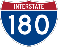
Interstate 180 (Pennsylvania)
| Basisdaten | |||||||||||||||||||||||||||||||||||||||||||||||||||||||
|---|---|---|---|---|---|---|---|---|---|---|---|---|---|---|---|---|---|---|---|---|---|---|---|---|---|---|---|---|---|---|---|---|---|---|---|---|---|---|---|---|---|---|---|---|---|---|---|---|---|---|---|---|---|---|---|
| Länge: | 28,85 mi/46,43 km | ||||||||||||||||||||||||||||||||||||||||||||||||||||||
| Bundesstaat: | Pennsylvania | ||||||||||||||||||||||||||||||||||||||||||||||||||||||
| Verlaufsrichtung: | Ost-West | ||||||||||||||||||||||||||||||||||||||||||||||||||||||
| Karte | |||||||||||||||||||||||||||||||||||||||||||||||||||||||
 | |||||||||||||||||||||||||||||||||||||||||||||||||||||||
Verlauf
| |||||||||||||||||||||||||||||||||||||||||||||||||||||||
Die Interstate 180 (kurz I-180) ist ein Zubringer, der die Interstate 80 bei Milton mit den U.S. Highways 15 und 220 in Williamsport auf einer Länge von 46,43 Kilometer (28,85 Meilen) verbindet.
Sie ist für ihre gesamte Länge als Ost-West-Route ausgezeichnet, obwohl sie zur Hälfte in Nord-Süd-Richtung verläuft.
Verlauf
Die Interstate 180 beginnt an einem Kreuz mit den U.S. Highways 15 und 220 im Süden von Williamsport, die zunächst beide die Trasse der I-180 nutzen. Die Interstate 180 verläuft parallel zum Susquehanna River in östlicher Richtung und im Osten von Williamsport verlässt der US 15 bereits wieder die Trasse in südlicher Richtung. Im Norden von Montoursville passiert sie den Williamsport Regional Airport und im Muncy Township verlässt auch der US 220 die Trasse. Die Interstate 180 führt anschließend ab Muncy in südlicher Richtung und endet nach 46 Kilometern nördlich von Milton an der Interstate 80.
Weblinks
- Interstate Guide (englisch)
- Pennsylvania Highways (englisch)
Auf dieser Seite verwendete Medien
750 mm by 600 mm (30 in by 24 in) Pennsylvania shield, made to the specifications of the Manual on Uniform Traffic Control Devices (MUTCD), 2003 Edition (sign M1-5). Uses the Roadgeek 2005 fonts. (United States law does not permit the copyrighting of typeface designs, and the fonts are meant to be copies of a U.S. Government-produced work anyway.)
750 mm × 600 mm (30 in × 24 in) U.S. Highway shield, made to the specifications of the 2004 edition of Standard Highway Signs. (Note that there is a missing "J" label on the left side of the diagram.) Uses the Roadgeek 2005 fonts. (United States law does not permit the copyrighting of typeface designs, and the fonts are meant to be copies of a U.S. Government-produced work anyway.)
600 mm by 600 mm (24 in by 24 in) Pennsylvania shield, made to the specifications of the Manual on Uniform Traffic Control Devices (MUTCD), 2003 Edition (sign M1-5). Uses the Roadgeek 2005 fonts. (United States law does not permit the copyrighting of typeface designs, and the fonts are meant to be copies of a U.S. Government-produced work anyway.)
600 mm × 600 mm (24 in × 24 in) U.S. Highway shield, made to the specifications of the 2004 edition of Standard Highway Signs. (Note that there is a missing "J" label on the left side of the diagram.) Uses the Roadgeek 2005 fonts. (United States law does not permit the copyrighting of typeface designs, and the fonts are meant to be copies of a U.S. Government-produced work anyway.)
600 mm by 600 mm (24 in by 24 in) Pennsylvania shield, made to the specifications of the Manual on Uniform Traffic Control Devices (MUTCD), 2003 Edition (sign M1-5). Uses the Roadgeek 2005 fonts. (United States law does not permit the copyrighting of typeface designs, and the fonts are meant to be copies of a U.S. Government-produced work anyway.)
Autor/Urheber: 25or6to4, Lizenz: CC BY-SA 3.0
Map of Interstate 180 in Pennsylvania
600 mm by 600 mm (24 in by 24 in) Interstate shield, made to the specifications of the 2004 edition of Standard Highway Signs (sign M1-1). Uses the Roadgeek 2005 fonts. (United States law does not permit the copyrighting of typeface designs, and the fonts are meant to be copies of a U.S. Government-produced work anyway.) Colors are from [1] (Pantone Red 187 and Blue 294), converted to RGB by [2]. The outside border has a width of 1 (1 mm) and a color of black so it shows up; in reality, signs have no outside border.


