Diapontische Inseln
| Diapontische Inseln | ||
|---|---|---|
 | ||
| Gewässer | Mittelmeer | |
| Archipel | Ionische Inseln | |
| Geographische Lage | 39° 49′ N, 19° 30′ O | |
| Anzahl der Inseln | 11 | |
| Hauptinsel | Othoni | |
| Einwohner | 1700 (2001) | |
 | ||
Die Diapontischen Inseln (griechisch Διαπόντια νησιάDiapóndia nisiá (n. pl.), auch Othonische Inseln) sind eine Inselgruppe im Norden der Ionischen Inseln nordwestlich von Korfu. Sie bilden die nordwestlichste Inselgruppe von Griechenland. Bis 1947 wurde auch Sazan zur Inselgruppe gezählt.
Auf den drei bewohnten Inseln Othoni, Errikousa und Mathraki leben etwa 1.700 Personen.[1] Die drei bewohnten Inseln bildeten bis 2010 eigene Gemeinden; zum 1. Januar 2011 gingen sie zunächst in der Gemeinde Kerkyra auf, bilden seither Gemeindebezirke und wählen als Ortschaften eigene lokale Vertretungen. 2019 kamen die Inseln zur neu gebildeten Gemeinde Kendriki Kerkyra ke Diapondia Nisia.
Zur Inselgruppe zählen noch einige unbewohnte Eilande und Felsenriffe.
Eine regelmäßige Fährverbindung besteht mit Korfus Hauptstadt Kerkyra.
Die einzelnen Inseln
| Name | griechischer Name | Gemeindebezirk | höchste Erh.[2] | Lage |
|---|---|---|---|---|
| Errikousa (Merlera) | η Ερρείκουσα (Μερλερά) | Erikoussa | 130 m | 39° 53′ 16″ N, 19° 35′ 0″ O |
| Othoni (Fanos) | οι Οθωνοί (Φανός) | Othoni | 393 m | 39° 51′ 8″ N, 19° 23′ 55″ O |
| Kastrino | το Καστρινό | Othoni | ||
| Ostrako | το Όστρακο | Othoni | ||
| Mathraki (Malthaki) | το Μαθράκι (Μαλθάκι) | Mathraki | 155 m | 39° 46′ 9″ N, 19° 31′ 21″ O |
| Diakopo | το Διάκοπο | Mathraki | 39° 45′ 50″ N, 19° 35′ 19″ O | |
| Diaplo | το Διάπλο | Mathraki | 39° 46′ 3″ N, 19° 35′ 34″ O | |
| Karavi | το Καράβι | Mathraki | 39° 45′ 50″ N, 19° 35′ 19″ O | |
| Lipso (Varka) | η Λειψώ (Βάρκα) | Mathraki | ||
| Plaka (Angyra) | Πλάκα (Άγκυρα) | Mathraki | ||
| Trachia | η Τραχειά (Τραχιά) | Mathraki | 39° 46′ 21″ N, 19° 29′ 44″ O |
Einzelnachweise
- ↑ Informationen. (Memento des vom 24. September 2015 im Internet Archive) Info: Der Archivlink wurde automatisch eingesetzt und noch nicht geprüft. Bitte prüfe Original- und Archivlink gemäß Anleitung und entferne dann diesen Hinweis. (PDF) Griechischer statistischer Dienst
- ↑ Die Daten folgen Angaben auf GTP
Auf dieser Seite verwendete Medien
Autor/Urheber: Xfigpower, Lizenz: CC BY-SA 4.0
Location map of Ionian Islands, Greece
Geographic limits of the map:
- N: 40.0° N
- S: 37.2° N
- W: 19.3° E
- O: 21.3° E
Autor/Urheber: godo godaj, Lizenz: CC BY 2.0
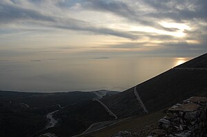
Panorama from Llogara pass in Southern Albania. Small Greek islands of Othoni (right), Mathraki (center) and Erikoussa (left)
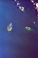
Diaponic Islands, Greece
Mission: STS099 Roll: ESC Frame: 9142506
Country or Geographic Name: GREECE
Features: MEDITERRANEAN SEA AND ALBANIA
Center Point Latitude: 39.8 Center Point Longitude: 19.5 (Negative numbers indicate south for latitude and west for longitude)
- Image Science and Analysis Laboratory, NASA-Johnson Space Center. "The Gateway to Astronaut Photography of Earth."
- <http://eol.jsc.nasa.gov/scripts/sseop/photo.pl?mission=STS099&roll=ESC&frame=9142506> (10/04/2009) .
- Send questions or comments to the NASA Responsible Official at jsc-earthweb@mail.nasa.gov
- Curator: Earth Sciences Web Team
- Notices: Web Accessibility and Policy Notices, NASA Web Privacy Policy


