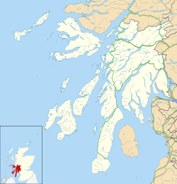
Colonsay Airport
| Colonsay Airport | ||
|---|---|---|
 | ||
| ||
| Kenndaten | ||
| ICAO-Code | EGEY | |
| IATA-Code | CSA | |
| Koordinaten | 56° 3′ 27″ N, 6° 14′ 35″ W | |
| Höhe über MSL | 13 m (43 ft) | |
| Verkehrsanbindung | ||
| Entfernung vom Stadtzentrum | 5,6 km westlich von Scalasaig | |
| Basisdaten | ||
| Betreiber | Argyll and Bute Council | |
| Start- und Landebahn | ||
| 11/29 | 501 m × 18 m Asphalt | |
Colonsay Airport (schottisch-gälisch Port-adhair Colbhasaigh, IATA-Code: CSA, ICAO-Code: EGEY) befindet sich auf der Hebrideninsel Colonsay in der Council Area Argyll and Bute vor der Westküste Schottlands. Betreiber und Besitzer ist das Argyll and Bute Council. Es ist ein kleiner Flugplatz, mit zwei 25-minütigen Flügen jeden Dienstag und Donnerstag zum Flughafen Oban von Hebridean Air Services. Die Linienflüge begannen im Jahr 2006, nachdem der Grasflugplatz mit einer gepflasterten Landebahn aufgerüstet wurde.
Weblinks
Auf dieser Seite verwendete Medien
Contains Ordnance Survey data © Crown copyright and database right, CC BY-SA 3.0
Blank map of Argyll and Bute, UK with the following information shown:
- Administrative borders
- Coastline, lakes and rivers
- Roads and railways
- Urban areas
Equirectangular map projection on WGS 84 datum, with N/S stretched 175%
Geographic limits:
- West: 7.2W
- East: 4.5W
- North: 56.8N
- South: 55.2N
Autor/Urheber: Gordon Ross, Lizenz: CC BY-SA 2.0
Hebridean Air Services Britten-Norman Islander lined up for take off at Colonsay Airport


