Ciudad Ayala
| Ciudad Ayala | |
|---|---|
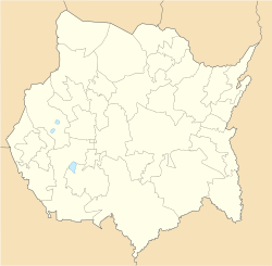
| Koordinaten: 18° 46′ N, 98° 59′ W Ciudad Ayala auf der Karte von Morelos | |
| Basisdaten | |
| Staat | Mexiko |
| Bundesstaat | Morelos |
| Municipio | Ayala |
| Einwohner | 6777 (2010) |
| Stadtinsignien | |
| Detaildaten | |
| Höhe | 1220 m |
| Vorwahl | 735 |
Ciudad Ayala ist eine Stadt im mexikanischen Bundesstaat Morelos. Sie liegt 1220 m hoch, hatte im Jahr 2010 6.777 Einwohner und ist Verwaltungssitz des Municipio Ayala, das früher San Francisco Mapachtlán geheißen hat.
Ciudad Ayala ist hauptsächlich bekannt durch den Plan von Ayala, in dem sich Emiliano Zapata und seine Anhänger 1911 ein Programm gegeben haben.
Auf dieser Seite verwendete Medien
Location Map of Morelos Equirectangular projection, Geographic limits of the map:
- N: 19.16° N
- S: 18.30° N
- W: 99.51° W
- E: 98.58° W
Autor/Urheber: Munoespi20, Lizenz: CC BY-SA 3.0
Escudo del municipio de Ayala, Morelos.


