Canton (Connecticut)
| Canton | ||
|---|---|---|
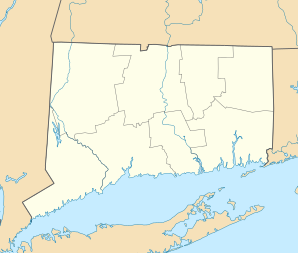
Lage in Connecticut | ||
| Basisdaten | ||
| Gründung: | 1806 | |
| Staat: | Vereinigte Staaten | |
| Bundesstaat: | Connecticut | |
| County: | Hartford County | |
| Koordinaten: | 41° 52′ N, 72° 55′ W | |
| Zeitzone: | Eastern (UTC−5/−4) | |
| Einwohner: | 10.124 (Stand: 2020) | |
| Haushalte: | 4.238 (Stand: 2020) | |
| Fläche: | 64,9 km² (ca. 25 mi²) davon 63,6 km² (ca. 25 mi²) Land | |
| Bevölkerungsdichte: | 159 Einwohner je km² | |
| Höhe: | 121 m | |
| Postleitzahlen: | 06019, 06020, 06022, 06059 | |
| Vorwahl: | +1 860 | |
| FIPS: | 09-12270 | |
| GNIS-ID: | 0213404 | |
| Website: | www.townofcantonct.org | |
Canton ist eine Stadt im Hartford County im US-Bundesstaat Connecticut, Vereinigte Staaten. Das U.S. Census Bureau hat bei der Volkszählung 2020 eine Einwohnerzahl von 10.124[1] ermittelt. Das Stadtgebiet hat eine Größe von 64,9 km².
Canton wurde 1737 das erste Mal als Siedlung erwähnt. 1806 wurde sie zur Stadt. Canton hat Anbindung an die US-Routes 44 und 202 und liegt etwa 22 km westlich von Hartford.
Schulen
- Cherry Brook Primary School
- Canton Intermediate School
- Canton Middle School
- Canton High School
Söhne und Töchter der Stadt
- Lucien Barbour (1811–1880), Jurist und Politiker
- Philemon Bliss (1813–1889), Jurist und Politiker
Weblinks
Einzelnachweise
- ↑ Explore Census Data Canton town, Hartford County, Connecticut. Abgerufen am 11. November 2022.
Auf dieser Seite verwendete Medien
Autor/Urheber: Alexrk2, Lizenz: CC BY 3.0
Diese Landkarte wurde mit GeoTools erstellt.
This is a locator map showing Hartford County in Connecticut. For more information, see Commons:United States county locator maps.


