Cameron Airpark
| Cameron Airpark | ||
|---|---|---|
 | ||
| Kenndaten | ||
| FAA-LID | O61 | |
| Koordinaten | 38° 41′ 2″ N, 120° 59′ 15″ W | |
| Höhe über MSL | 392 m (1.286 ft) | |
| Verkehrsanbindung | ||
| Entfernung vom Stadtzentrum | 3 km von Cameron Park (Kalifornien) | |
| Basisdaten | ||
| Eröffnung | nicht bekannt | |
| Start- und Landebahn | ||
| 13/31 | 1235 m × 15 m Asphalt | |
Cameron Airpark (FAA-LID: O61)[1] ist ein Flugplatz in der Stadt Cameron Park im El Dorado County, Kalifornien, Vereinigte Staaten.
Beschaffenheit
Der Flugplatz wird für die allgemeine Luftfahrt verwendet. Die asphaltierte Startbahn hat eine Länge von 1235 m. Das Gebiet im Westen der Start- und Landebahn ist ein öffentlicher Flugzeugpark, wo Hausbesitzer ihre Flugzeuge bis zu ihren Häusern rollen und auch dort unterbringen können. Die Ostseite der Start- und Landebahn steht für Anwohner zur freien Benutzung zur Verfügung. Die Landebahn und das allgemeine Flughafengelände wird von einem Rat der Hausbesitzer betrieben. Die erhöhte Fläche im Osten der Landebahn ist Besitz von Privatpersonen.
Weblinks
Einzelnachweise
- ↑ AirportIQ - =61. Archiviert vom ; abgerufen am 12. März 2025 (englisch).
Auf dieser Seite verwendete Medien
Autor/Urheber: NordNordWest, Lizenz: CC BY 3.0
Positionskarte von Kalifornien, USA
Autor/Urheber: TUBS
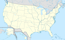
Location map of the USA (Hawaii and Alaska shown in sidemaps).
Main map: EquiDistantConicProjection : Central parallel :
* N: 37.0° N
Central meridian :
* E: 96.0° W
Standard parallels:
* 1: 32.0° N
* 2: 42.0° N
Made with Natural Earth. Free vector and raster map data @ naturalearthdata.com.
Formulas for x and y:
x = 50.0 + 124.03149777329222 * ((1.9694462586094064-({{{2}}}* pi / 180))
      * sin(0.6010514667026994 * ({{{3}}} + 96) * pi / 180))
y = 50.0 + 1.6155950752393982 * 124.03149777329222 * 0.02613325650382181
      - 1.6155950752393982  * 124.03149777329222 *
     (1.3236744353715044  - (1.9694462586094064-({{{2}}}* pi / 180))
      * cos(0.6010514667026994 * ({{{3}}} + 96) * pi / 180))
Hawaii side map: Equirectangular projection, N/S stretching 107 %. Geographic limits of the map:
- N: 22.4° N
- S: 18.7° N
- W: 160.7° W
- E: 154.6° W
Alaska side map: Equirectangular projection, N/S stretching 210.0 %. Geographic limits of the map:
- N: 72.0° N
- S: 51.0° N
- W: 172.0° E
- E: 129.0° W
Flag of California. This version is designed to accurately depict the standard print of the bear as well as adhere to the official flag code regarding the size, position and proportion of the bear, the colors of the flag, and the position and size of the star.
Autor/Urheber: Finetooth, Lizenz: CC BY-SA 3.0
Eastern side of Cameron Airpark in the U.S. state of California.


