Bray Island
| Bray Island | ||
|---|---|---|
 | ||
| Gewässer | Foxe Basin | |
| Inselgruppe | Kanadisch-arktischer Archipel | |
| Geographische Lage | 69° 16′ N, 77° 0′ W | |
| Länge | 37 km | |
| Breite | 25 km | |
| Fläche | 689 km² | |
| Einwohner | unbewohnt | |
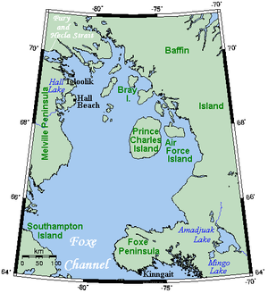
Karte von Bray Island | ||
Bray Island ist eine Insel im Kanadisch-arktischen Archipel in der Qikiqtaaluk-Region des kanadischen Territoriums Nunavut.
Sie liegt im Foxe Basin vor der Südküste von Baffin Island. Die Insel hat eine Fläche von 689 km².[1]
Bray Island war Standort von FOX-A, einer Station der Distant Early Warning Line. Heute befindet sich auf der Insel eine Einrichtung des North Warning System.
Einzelnachweise
- ↑ Natural Resources Canada - The Atlas of Canada - Sea Islands (Memento vom 6. Oktober 2012 im Internet Archive)
Auf dieser Seite verwendete Medien
Autor/Urheber:
- Canada_Nunavut_location_map-lambert_proj.svg: Flappiefh
- derivative work: NordNordWest
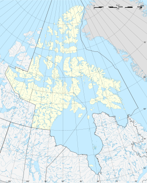
Positionskarte von Nunavut, Kanada
Autor/Urheber: Original uploader was Kelisi at en.wikipedia, Lizenz: CC BY-SA 3.0
A map showing Foxe Basin and nearby areas. This map's source is here, with the uploader's modifications, and the GMT homepage says that the tools are released under the GNU General Public License.


