Benton County (Indiana)
 Das Benton County Courthouse in Fowler, gelistet im NRHP | |
| Verwaltung | |
|---|---|
| US-Bundesstaat: | Indiana |
| Verwaltungssitz: | Fowler |
| Adresse des Verwaltungssitzes: | County Courthouse 706 East 5th Street Fowler, IN 47944-1556 |
| Gründung: | 18. Februar 1840 |
| Gebildet aus: | Jasper County |
| Vorwahl: | 001 765 |
| Demographie | |
| Einwohner: | 8.719 (Stand: 2020) |
| Bevölkerungsdichte: | 8,28 Einwohner/km2 |
| Geographie | |
| Fläche gesamt: | 1053 km² |
| Wasserfläche: | 0,2 km² |
| Karte | |
 | |
| Website: www.bentoncounty.in.gov | |
Das Benton County[1] ist ein County im US-amerikanischen Bundesstaat Indiana. Im Jahr 2010 hatte das County 8854 Einwohner und eine Bevölkerungsdichte von 8,4 Einwohnern pro Quadratkilometer.[2] Der Verwaltungssitz (County Seat) ist Fowler.[3]
Das Benton County ist Bestandteil der Metropolregion um die im südöstlich benachbarten Tippecanoe County gelegene Stadt Lafayette.
Geografie
Das County liegt im Nordwesten von Indiana und grenzt im Westen an Illinois. Es hat eine Fläche von 1053 Quadratkilometern ohne nennenswerte Wasserfläche. An das Benton County grenzen folgende Nachbarcountys:
| Newton County | Jasper County | |
| Iroquois County (Illinois) | .svg) | White County |
| Vermilion County (Illinois) | Warren County | Tippecanoe County |

Windenergieanlage

Freeland Park
Indiana Park
Geschichte
.jpg)
Das Benton County wurde am 18. Februar 1840 aus Teilen des Jasper County gebildet. Benannt wurde es nach Thomas H. Benton (1782–1858), einem amerikanischen Politiker und US-Senator.
Wirtschaft
Demografische Daten
| Bevölkerungsentwicklung | |||
|---|---|---|---|
| Census | Einwohner | ± rel. | |
| 1850 | 1144 | — | |
| 1860 | 2809 | 145,5 % | |
| 1870 | 5615 | 99,9 % | |
| 1880 | 11.108 | 97,8 % | |
| 1890 | 11.903 | 7,2 % | |
| 1900 | 13.123 | 10,2 % | |
| 1910 | 12.688 | −3,3 % | |
| 1920 | 12.206 | −3,8 % | |
| 1930 | 11.886 | −2,6 % | |
| 1940 | 11.117 | −6,5 % | |
| 1950 | 11.462 | 3,1 % | |
| 1960 | 11.912 | 3,9 % | |
| 1970 | 11.262 | −5,5 % | |
| 1980 | 10.218 | −9,3 % | |
| 1990 | 9441 | −7,6 % | |
| 2000 | 9421 | −0,2 % | |
| 2010 | 8854 | −6 % | |
| 2020 | 8.719 | −1,5 % | |
| Vor 1900[4] 1900–1990[5] 2000[3] 2010[2] | |||
Nach der Volkszählung im Jahr 2010 lebten im Benton County 8854 Menschen in 3581 Haushalten. Die Bevölkerungsdichte betrug 8,4 Einwohner pro Quadratkilometer. In den 3581 Haushalten lebten statistisch je 2,42 Personen.
Ethnisch betrachtet setzte sich die Bevölkerung zusammen aus 97,9 Prozent Weißen, 0,8 Prozent Afroamerikanern, 0,2 Prozent amerikanischen Ureinwohnern, 0,2 Prozent Asiaten sowie aus anderen ethnischen Gruppen; 0,8 Prozent stammten von zwei oder mehr Ethnien ab. Unabhängig von der ethnischen Zugehörigkeit waren 4,9 Prozent der Bevölkerung spanischer oder lateinamerikanischer Abstammung.
25,2 Prozent der Bevölkerung waren unter 18 Jahre alt, 59,2 Prozent waren zwischen 18 und 64 und 15,6 Prozent waren 65 Jahre oder älter. 50,4 Prozent der Bevölkerung war weiblich.
Das jährliche Durchschnittseinkommen eines Haushalts lag bei 47.240 USD. Das Pro-Kopf-Einkommen betrug 22.461 USD. 12,0 Prozent der Einwohner lebten unterhalb der Armutsgrenze.[2]
Ortschaften im Benton County
|
|
|
|
|
|
1 – teilweise im Tippecanoe County
Gliederung

Das Benton County ist in elf Townships eingeteilt[6]
|
|
Siehe auch
Einzelnachweise
- ↑ GNIS-ID: 450403. Abgerufen am 22. Februar 2011 (englisch).
- ↑ a b c Quick Facts Benton County. US Census Bureau, abgerufen am 25. August 2021.
- ↑ a b National Association of Counties Abgerufen am 10. Dezember 2012
- ↑ U.S. Census Bureau - Census of Population and Housing Abgerufen am 15. März 2011
- ↑ Auszug aus Census.gov Abgerufen am 15. Februar 2011
- ↑ Benton County Minor Civil Divisions. Missouri Census Data Center, abgerufen am 25. August 2021.
Weblinks
Liste der Countys in Indiana
Adams | Allen | Bartholomew | Benton | Blackford | Boone | Brown | Carroll | Cass | Clark | Clay | Clinton | Crawford | Daviess | DeKalb | Dearborn | Decatur | Delaware | Dubois | Elkhart | Fayette | Floyd | Fountain | Franklin | Fulton | Gibson | Grant | Greene | Hamilton | Hancock | Harrison | Hendricks | Henry | Howard | Huntington | Jackson | Jasper | Jay | Jefferson | Jennings | Johnson | Knox | Kosciusko | LaGrange | Lake | LaPorte | Lawrence | Madison | Marion | Marshall | Martin | Miami | Monroe | Montgomery | Morgan | Newton | Noble | Ohio | Orange | Owen | Parke | Perry | Pike | Porter | Posey | Pulaski | Putnam | Randolph | Ripley | Rush | St. Joseph | Scott | Shelby | Spencer | Starke | Steuben | Sullivan | Switzerland | Tippecanoe | Tipton | Union | Vanderburgh | Vermillion | Vigo | Wabash | Warren | Warrick | Washington | Wayne | Wells | White | Whitley
Koordinaten: 40° 36′ N, 87° 19′ W
Auf dieser Seite verwendete Medien
Thomas Hart Benton — Democratic Senator from Missouri, 1821-1851
Front of the Benton County Courthouse, located at 706 E. Fifth Street in Fowler, Indiana, United States. Built in 1874, it is listed on the National Register of Historic Places.
This is a map of Benton County, Indiana, USA which includes settlements and township borders.

A water pump stands in the town park in the small community of Freeland Park, Indiana. Photo looks southwest from Carpenter Street (County Road 907 West).

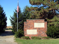
Ambia Alumni Association Memorial Park in the town of Ambia, Indiana, looking west from near the intersection of Walnut Street and Second Street. The engravings read:
Memoriam
Ambia High School
1899-1968
Dedicated
Jun 24, 1989
by
Ambia Alumni Association
W. H. Taylor Trustee
Advisory Board
J. J. Schindler
Jos Kirsch - M. McCormick
Erected 1917
Chas W. Nicol, Architect
Baker & Price Contractors

This is a locator map showing Benton County in Indiana. For more information, see Commons:United States county locator maps.
