Beartooth Highway
| Beartooth Highway | ||
|---|---|---|
| National Register of Historic Places | ||
Der Beartooth Highway nahe dem Beartooth Pass | ||
| Lage | Beartooth Mountains, Montana/Wyoming | |
| Koordinaten | 44° 58′ 1″ N, 109° 28′ 0″ W | |
| Ins NRHP aufgenommen | 8. Mai 2014 | |
| Karte | ||||||||||||||||||||||||||||||||||||||||||||||||||||||||||||||||
|---|---|---|---|---|---|---|---|---|---|---|---|---|---|---|---|---|---|---|---|---|---|---|---|---|---|---|---|---|---|---|---|---|---|---|---|---|---|---|---|---|---|---|---|---|---|---|---|---|---|---|---|---|---|---|---|---|---|---|---|---|---|---|---|---|
 | ||||||||||||||||||||||||||||||||||||||||||||||||||||||||||||||||
| Basisdaten | ||||||||||||||||||||||||||||||||||||||||||||||||||||||||||||||||
| Gesamtlänge: | 111 km (69 mi) | |||||||||||||||||||||||||||||||||||||||||||||||||||||||||||||||
| Eröffnung: | 14. Juni 1936 | |||||||||||||||||||||||||||||||||||||||||||||||||||||||||||||||
| Bundesstaaten: | Wyoming Montana | |||||||||||||||||||||||||||||||||||||||||||||||||||||||||||||||
| Anfangspunkt: | Red Lodge, Montana | |||||||||||||||||||||||||||||||||||||||||||||||||||||||||||||||
| Endpunkt: | Nordosteingang des Yellowstone-Nationalparks | |||||||||||||||||||||||||||||||||||||||||||||||||||||||||||||||
| Wichtige Städte: | Red Lodge Cooke City | |||||||||||||||||||||||||||||||||||||||||||||||||||||||||||||||
Verlauf
| ||||||||||||||||||||||||||||||||||||||||||||||||||||||||||||||||
Der Beartooth Highway ist eine 111 km (69 Meilen) lange All-American Road zwischen den Ortschaften Red Lodge im US-Bundesstaat Montana und Cooke City im US-Bundesstaat Montana, gleich angrenzend an den Nordost-Eingang in den Yellowstone-Nationalpark.
Er führt dabei vom oberen Flusstal des Rock Creek über die Beartooth Mountains zum südlich verlaufenden Oberlauf des Clarks Fork Yellowstone River. Der mittlere Streckenabschnitt liegt im US-Bundesstaat Wyoming und erreicht am Beartooth Pass eine Höhe von 3336 m (10,947 feet). Aufgrund seiner geographischen Höhe und den Beeinträchtigungen durch Schneefall ist der Pass normalerweise nur zwischen Mai und Oktober geöffnet.[1] Der Highway ist Teil der U.S. Route 212.
Am 8. Mai 2014 wurde die Strecke als Kulturdenkmal in das National Register of Historic Places aufgenommen.[2]
Weblinks
Einzelnachweise
- ↑ Beartooth Highway Points of Interest, Red Lodge Montana Chamber of Commerce. Abgerufen am 29. Juni 2014.
- ↑ Beartooth Highway Receives Prestigious National Register Listing. National Park Service, 20. Juni 2014, abgerufen am 21. Juni 2014.
Auf dieser Seite verwendete Medien
Wellenlinie als Gewässersymbol für die Formatvorlage Autobahn
Zeichen 314-50: Parken. Das Zeichen ist in den Größen 420x420, 600x600 sowie 840x840 mm erhältlich. Die Unternummer wurde im Jahr 2017 gestrichen (nun: Zeichen 314).
Sinnbild innerorts
750 mm × 600 mm (30 in × 24 in) U.S. Highway shield, made to the specifications of the 2004 edition of Standard Highway Signs. (Note that there is a missing "J" label on the left side of the diagram.) Uses the Roadgeek 2005 fonts. (United States law does not permit the copyrighting of typeface designs, and the fonts are meant to be copies of a U.S. Government-produced work anyway.)
Autor/Urheber: Lpangelrob, Lizenz: CC BY-SA 3.0
The Beartooth Highway and Beartooth Mountains — from the Vista Point overlook in southern Montana.
- The Beartooth Highway is a scenic section of U.S. Route 212, climbing 3,000 feet (914 m) here over the Beartooth Mountains, with the highest elevation at Beartooth Pass (10,947 ft, 3,345 m).
Zeichen "Einmündende Straße von links"
oriented mountain pass symbol : n ne e se
Blick vom Aussichtspunkt nahe Beartooth Pass nach Südwesten
Route shield for Wyoming Highway.
Approaching Beartooth Pass [10,947 ft (3,337 m) high] from the west along the Beartooth Highway, which crosses the Beartooth Mountains.
- The Beartooth Mountains are a sub-mountain range of the Rocky Mountains System.
Zeichen 314-50: Parken. Das Zeichen ist in den Größen 420x420, 600x600 sowie 840x840 mm erhältlich. Die Unternummer wurde im Jahr 2017 gestrichen (nun: Zeichen 314).
Autor/Urheber: Alexrk, Lizenz: CC BY 3.0
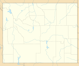
Positionskarte von Wyoming, USA


