SuperTyphoonNabi
Autor/Urheber:
NASA image created by Jesse Allen, Earth Observatory, using data obtained from the MODIS Rapid Response team.
Shortlink:
Quelle:
Größe:
7000 x 7000 Pixel (3713733 Bytes)
Beschreibung:
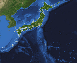
Super Typhoon Nabi was a Category 3 typhoon in the western Pacific when the Moderate Resolution Imaging Spectroradiometer (MODIS) on NASA’s Aqua satellite captured this image on September 2, 2005, at 11:55 a.m. Tokyo time. It had sustained winds of around 200 kilometers an hour (160 miles per hour) and was located roughly 1,000 kilometers (600 miles) from Saipan and Okinawa at that time. It was predicted to gather strength and make landfall at the southern end of the Korean peninsula early on September 7. However, the range of possible storm tracks as of September 2 takes in possibilities ranging from Shanghai on Asian mainland to Kyoto on the southern end of the Japanese Islands.
Kommentar zur Lizenz:
| Diese Datei ist gemeinfrei (public domain), da sie von der NASA erstellt worden ist. Die NASA-Urheberrechtsrichtlinie besagt, dass „NASA-Material nicht durch Urheberrecht geschützt ist, wenn es nicht anders angegeben ist“. (NASA-Urheberrechtsrichtlinie-Seite oder JPL Image Use Policy). |  | |
 |
Warnung:
|
Lizenz:
Public domain
Relevante Bilder
Relevante Artikel
Geographie JapansJapan ist nach Indonesien, Madagaskar und Papua-Neuguinea der viertgrößte Inselstaat der Welt. Er liegt im Pazifik vor den Küsten Russlands und Koreas. .. weiterlesen


