Senkaku Diaoyu Tiaoyu Islands
Autor/Urheber:
Attribution:
Das Bild ist mit 'Attribution Required' markiert, aber es wurden keine Informationen über die Attribution bereitgestellt. Vermutlich wurde bei Verwendung des MediaWiki-Templates für die CC-BY Lizenzen der Parameter für die Attribution weggelassen. Autoren und Urheber finden für die korrekte Verwendung der Templates hier ein Beispiel.
Shortlink:
Quelle:
Größe:
900 x 900 Pixel (290587 Bytes)
Beschreibung:
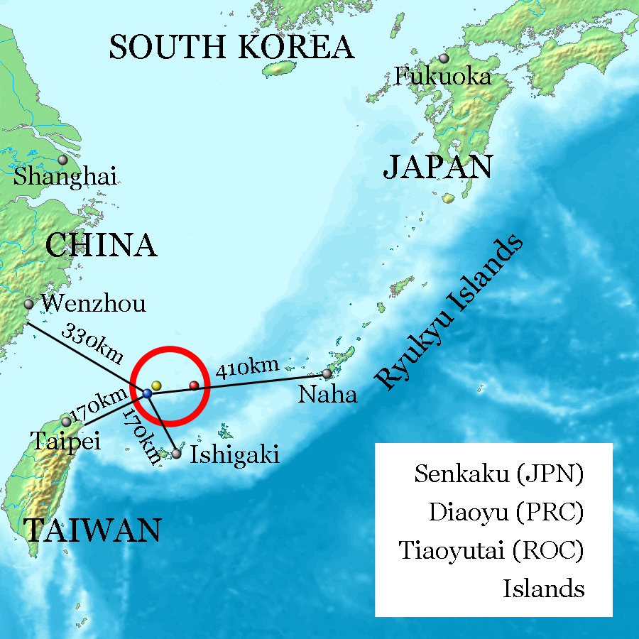
Uotsuri-shima / Diaoyu Dao (Blue, west end and nearly south end, 25°44′33″N 123°28′17″E at Mount Narahara), Kuba-shima / Huangwei Yu (Yellow, north end, 25°55′24″N 123°40′51″E at Mount Chitose), Taishō-tō / Chiwei Yu (Red, east end, 25°55′21″N 124°33′36″E at the peek) referenced on Geospatial Information Authority of Japan and distances referenced on Ministry of Foreign Affairs of Japan. Every distances of the map show coast to coast, but distances of the coast of Okinawa Island and Naha City, and the coast of Ishigaki-Island and Ishigaki City are quite near on the map.
Lizenz:
Bild teilen:


Relevante Bilder


Relevante Artikel
Senkaku-InselnDie Diaoyu/Senkaku-Inseln oder Diaoyu(tai)-Inseln sind eine unbewohnte Inselgruppe auf dem Festlandsockel im Ostchinesischen Meer. Sie liegen etwa 170 km nordöstlich von Taiwan und 150 km nördlich der japanischen Yaeyama-Inseln (Ishigaki-jima). .. weiterlesen