Puncak Jaya (NASA astronaut photograph)
Puncak Jaya, West Papua, Indonesia. The Grasberg (Freeport) copper mine pit is in the foreground, and remnants of the Puncak Jaya glaciers behind. The summit of Puncak Jaya is at the far end of the central rib. Two remnants of the Northwall Firn are to the left of the peak. The Meren Glacier was in the valley between these and the peak, but disappeared sometime between 1994 and 2000[1]. The Carstenz Glacier is immediately right of the peak. (White patches further to the right are clouds, which appear to be on the terrain surface due to the image processing technique used.)
At the current retreat rate, all these glaciers will be gone forever inside 10 years, making greater-Australia the first completely ice-free continent on the planet in 100,000 years. (Africa can't win. Kilimanjaro's ice is nearly gone, but there is still a fairly thick glacier left on Mount Kenya, and more in the Ruwenzori.)
This is a June 2005 NASA astronaut photograph draped over the NASA World Wind SRTM90 DTM and viewed from a similar angle to the 1936 and 1972 USGS photos of this tropical glacier group.
worldwind://goto/world=Earth&lat=-4.06986&lon=137.14256&alt=8039&dir=90.3&tilt=52.2 (Imagery mostly cloudy - try Geocover 1990.)
Also see

Made with NASA World Wind from NASA public domain imagery
Originally from en.wikipedia; description page is/was here.Relevante Bilder
Relevante Artikel
Puncak JayaDer Puncak Jaya, auch Carstensz-Pyramide und früher Djalaspitze oder Sukarno genannt, ist mit 4884 m Höhe der höchste Berg Ozeaniens und weltweit der höchste Berg auf einer Insel. Er liegt in der indonesischen Provinz Papua Tengah in Westneuguinea der Insel Neuguinea. Der Puncak Jaya gehört zur Sudirman Range, die ein Teil des Maokegebirges ist. Dieses ist alpidischen Ursprungs und durch das Abtauchen der Pazifischen Platte unter die Indisch-Australische Platte entstanden. .. weiterlesen
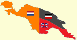
NeuguineaNeuguinea ist mit einer Fläche von 786.000 km² nach Grönland die zweitgrößte Insel der Erde. Der Westteil, Westneuguinea, wurde 1963 von Indonesien besetzt, 2003 in zwei Provinzen, Papua und Papua Barat, unterteilt; seit 2022 ist er in sechs Provinzen unterteilt. Der Osten der Insel ist seit 1975 Teil des unabhängigen Staates Papua-Neuguinea. Neuguinea besitzt den größten Tropenwald Australasiens, die reichhaltigsten Korallenriffe der Welt und einen der höchsten Biodiversitätsgrade der Welt. Weltweit einzigartig ist auch die Anzahl von über eintausend indigenen Sprachen. .. weiterlesen


