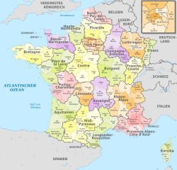
Carte démographique de la France
Autor/Urheber:
- Départements_de_France.svg: Bayo
- derivative work: Benjism89 (talk)
Attribution:
Das Bild ist mit 'Attribution Required' markiert, aber es wurden keine Informationen über die Attribution bereitgestellt. Vermutlich wurde bei Verwendung des MediaWiki-Templates für die CC-BY Lizenzen der Parameter für die Attribution weggelassen. Autoren und Urheber finden für die korrekte Verwendung der Templates hier ein Beispiel.
Shortlink:
Quelle:
Größe:
588 x 550 Pixel (419683 Bytes)
Beschreibung:
Demographic map of France. The following are represented:
- by single colours: the population densities per Metropolitan French department;
>5000/km2
300 to 1000/km2
150 to 250/km2
100 to 150/km2
70 to 100/km2
40 to 70/km2
<40/km2
- by dots: the 18 French cities which have a metropolitan area greater than 400,000 residents;
- by the continuous black line: Le Havre-Marseille line (60% of French population lives east of this line)
- by the dashed black line: the approximate limits of the empty diagonal.
Lizenz:
Credit:
Relevante Bilder
Relevante Artikel
DépartementEin Département [depaʁt(ə)mɑ̃] ist eine staatliche Verwaltungseinheit und zugleich Collectivité territoriale (Gebietskörperschaft) in Frankreich. .. weiterlesen


