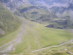
Alluvial fan, Taklimakan Desert, XinJiang Province, China, NASA, ASTER
Autor/Urheber:
NASA/GSFC/METI/ERSDAC/JAROS, and U.S./Japan ASTER Science Team
Shortlink:
Quelle:
Größe:
3774 x 4086 Pixel (3646938 Bytes)
Beschreibung:
A vast alluvial fan blossoms across the desolate landscape between the Kunlun and Altun mountain ranges that form the southern border of the Taklimakan Desert in China’s XinJiang Province. The left side is the active part of the fan, and appears blue from water currently flowing in the many small streams. The image was acquired May 2, 2002, covers an area of 56.6 × 61.3 km, and is centered near 37.4 degrees north, 84.3 degrees east.) A view of Google Maps and county maps in Xinjiang provincial atlas shows that the alluvial fan is formed by the river called Mòlèqiē Hé (莫勒切河) in Chinese (which, of course, is a Chinese "transcription" of a Uyghur name - sometimes transcribed as Molcha River). The fan is located in the western part of the Qiemo County.
Lizenz:
Public domain
Relevante Bilder
Relevante Artikel
SchwemmkegelEin Schwemmkegel, auch Schwemmfächer, Geröllfächer, Sandurs oder alluvialer Fächer genannt, ist ein subaerischer fluviatiler (angeschwemmter) Sedimentkörper, der dort entsteht, wo ein Fließgewässer abrupt an Gefälle verliert, typischerweise beim Austritt aus einem Hochgebiet in tieferliegendes, schwächer reliefiertes Gelände. .. weiterlesen


