Taifun Tokage
| Taifun (JMA) | |||
|---|---|---|---|
| Kategorie-4-Taifun (SSHWS) | |||
 | |||
| Entstehung | 13. Oktober 2004 | ||
| Auflösung | 20. Oktober 2004 | ||
| Spitzenwind- geschwindigkeit |
| ||
| Niedrigster Luftdruck | 940 hPa (mbar) | ||
| Tote | 95 | ||
| Sachschäden | Unbekannt | ||
| Betroffene Gebiete | Japan | ||
| Saisonübersicht: Pazifische Taifunsaison 2004 | |||
Taifun Tokage (japanisch:トカゲ, Eidechse; JMA-Bezeichnung: 0423; JTWC-Bezeichnung: 27W; PAGASA-Bezeichnung: Siony) war ein Taifun, der am 20. und 21. Oktober 2004 über Japan hinwegzog und eine Spur der Verwüstung hinterließ. Er war der stärkste tropische Wirbelsturm im nordwestlichen Pazifischen Ozean seit Taifun Tip. Seinen tiefsten Luftdruck erreichte er bei 940 hPa.
Dieser tropische Wirbelsturm war der 23. Taifun des Jahres 2004 und traf direkt die japanischen Inseln. Besonders betroffen war die Hauptinsel Honshū mit der Präfektur Kyōto. Tokage richtete Schäden in Höhe von über fünf Milliarden Euro an. 99 Tote, 704 Verletzte und drei Vermisste gingen auf sein Konto.
Entwicklung und Verlauf

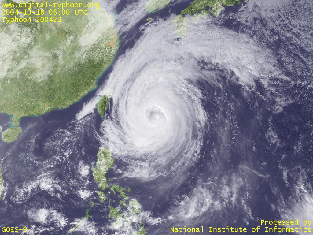
Taifun Tokage entstand am 12. Oktober 2004 östlich der Marianen und wurde vom Joint Typhoon Warning Center als tropischer Sturm klassifiziert. Zu diesem Zeitpunkt erreichte er eine durchschnittliche Windgeschwindigkeit von 35 Knoten. Fünf Tage später, am 17. Oktober, war Tokage mit 125 Knoten bereits ein Kategorie-4-Taifun. Aufgrund eines Kurswechsels, ausgelöst durch die darunterliegende Meeresströmung, schwächte er sich bis zum nächsten Tag ab und war am 18. Oktober mit 105 Knoten nur noch ein Kategorie-3-Taifun.
Am 20. Oktober traf Tokage auf das japanische Festland. Einen Tag später, am 21. Oktober, verließ er die Inseln in Richtung Nordosten und löste sich am 23. Oktober auf.
Weblinks
- Zugbahn
- Taifun Tokage vor Taiwan
- Durch Tokage verursachte Schäden (englisch)
- Kabinettsbüro: Katastrophenschutzbericht Taifun Nr. 23 (PDF; 297 kB, japanisch)
Auf dieser Seite verwendete Medien
Track map of Typhoon Tokage of the 2004 Pacific typhoon season. The points show the location of the storm at 6-hour intervals. The colour represents the storm's maximum sustained wind speeds as classified in the (see below), and the shape of the data points represent the nature of the storm, according to the legend below.
Storm type
The Moderate Resolution Imaging Spectroradiometer (MODIS) flying aboard the Terra satellite captured this true-color image of Typhoon Tokage on October 19, 2004, at 2:15 UTC. At the time this image was taken Tokage was located approximately 23 miles south-southeast of Okinawa, Japan, and was moving towards the north-northeast at 27 km/hr (15 mph). Generating winds of up to 173 km/hr (107 mph), Tokage—“lizard” in Japanese—was expected to hit Kyushu, Japan’s southernmost main island, on Wednesday to become the record 10th typhoon to make landfall in Japan this year. Experts say Japan has suffered from an unusual number of storms this year due to warmer offshore waters and weaker than normal Pacific high pressure areas.