Steinschüttung

Eine Steinschüttung ist eine aufgeschüttete Schicht aus Bruchsteinen. Im Wasserbau dient sie bei Flüssen und Kanälen der Befestigung der Ufer, der Gewässersohle oder dem Bau von Buhnen oder Längswerken. Auch beim Bau von Staudämmen wird sie als Schüttmaterial eingesetzt.
Auch zum Schutz von Brückenpfeilern oder Leuchttürmen können Steinschüttungen eingesetzt werden. Die Steingröße wird so bestimmt, dass die Schüttung den angreifenden Wassermassen ausreichend Widerstand entgegenstellen kann.
Mit einer Steinschüttung kann bei Bedarf die Tragfähigkeit von Baugrund erhöht werden.[1][2]
Es gibt lose und gebundene Steinschüttungen.
Für die Stabilität loser, unverklammerter Steinschüttungen sind die Kornverteilung und die Dicke der Schüttlage entscheidend, aus denen der Hohlraumgehalt und die Hohlraumgröße bestimmt werden können.[3]
Galerie

Beton-Trümmer, die als Steinschüttung entlang der San Francisco Bay Küstenlinie verwendet wurden
 (c) Jonathan Wilkins, CC BY-SA 2.0
Modulare Betonstein-Steinschüttung

Modulare Betonklotz-Steinschüttung

Steinschüttung um die Pfeiler der Mainzer Südbrücke

Steinschüttung-Auskleidung eines Seeufers

Steinschüttung zur Schließung eines Kanals am Mississippi

Steinschüttung zum Schutz eines Deichs

Besatzungen ersetzen Steinschüttung bei Galveston-Deich nach einem Hurrikan von 1915

Einzelnachweise
Auf dieser Seite verwendete Medien

Autor/Urheber: Bari Élisabeth, Lizenz: CC BY-SA 4.0
Südbrücke Dans les années 1859 à 1862, le pont sud a été construit selon les plans du chef du service de la construction des ponts de la fonderie de fer Klett & Comp. de Nuremberg , Heinrich Gottfried Gerber tours de pont sud. On peut accéder au pont à pied ou à vélo, la partie rail ne possède qu'une voie .Le 17 mars 1945, des pionniers de la Wehrmacht ont fait sauter le pont sud afin de stopper l'avancée des troupes américaines. Le pont a été reconstruit en 1948. Les structures sont en fermes acier K.

Rip-rapped shoreline at Agua Vista park, San Francisco.

Autor/Urheber: 663highland, Lizenz: CC BY 2.5
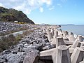
Cape Hinomisaki in Izumo, Shimane prefecture, Japan
Autor/Urheber: Hagen Graebner, Lizenz: CC BY-SA 3.0
Polder bei Ingelheim, Durchlassbauwerk, Steinschüttung an der Flussseite

(c) Jonathan Wilkins, CC BY-SA 2.0
Sea defences The route of the A55 'Col-Con' Expressway was severely constrained by the coastal topography and built environment. Here the road passes through the site of a large coastal quarry and considerable engineering was required to create and defend the new formation. Cast-concrete anchor blocks interlock to provide a primary energy-dispersive barrier, with conventional rock-armour to stabilise the upper slope. Very geometric, but very dangerous because the structure includes large voids into which anything can drop easily.
.jpg)
Completed in 2009, the U.S. Army Corps of Engineers rebuilt and added rip rap, or large rock, to the waterside banks of a 400-foot stretch of levee near the Yolo Bypass to address issues with slumping. The repair work was completed as part of the West Sacramento Project, a joint effort with the West Sacramento Area Flood Control Agency and the Central Valley Flood Protection Board to improve the levees surrounding West Sacramento. (U.S. Army Photo by Tyler Stalker/Released)
.jpg)
from north end of island, facing upstream
This series of photos was taken on July 12, 2005, on and near NPS Island 112-02 during a canoe safety training for new staff. The images depict construction by the U.S. Army Corps of Engineers of a partial closing structure made of riprap, dredged material and live plant material. The purpose of the structure is to control erosion on the upstream end of the island and to create new wildlife habitat. This project is part of the Corps' Channel Maintenance Management Plan. NPS Island 112-02 is located in Mississippi River Pool 2 at River Mile 827.5
- Keywords: mnrra; mississippi river; pool 2; nps island 112-02; riprap; habitat; erosion control; u.s. army corps of engineers; Rivers; Islands; Construction and Engineering; Wildlife management; Vegetation restoration

Crews replacing riprap at Seawall