Pulau Tabawan
| Pulau Tabawan | ||
|---|---|---|
 | ||
| Gewässer | Celebessee | |
| Geographische Lage | 4° 47′ 43″ N, 118° 22′ 56″ O | |
| Länge | 7 km | |
| Breite | 2,6 km | |
| Höchste Erhebung | 275 m | |
Pulau Tabawan ist eine zu Malaysia gehörende Insel in der zur Celebessee offenen Darvel Bay. Die Insel liegt etwa 60 Kilometer östlich von Kunak. Wegen ihrer Perlenfarmen wird sie manchmal auch Pearl Island genannt. Der Name „Tabawan“ entstammt der chinesischen Sprache 大把湾 und bedeutet „so viele Buchten“.
Pulau Tabawan ist die größte Insel einer dicht bewaldeten Gruppe von Inseln im Südwesten der Darvel Bay. Wegen ihres 275 m hohen Gipfels – dem höheren von zwei Gipfeln vulkanischen Ursprungs – ist sie leicht zu erkennen. Zwischen zwei Vorgebirgen im Süden der Insel liegt eine bis zu 36 m tiefe Bucht.[1]
Nutzung
Die Insel war wegen der hier angesiedelten Perlenfarmen lange Zeit nicht oder nur sehr schwer zugänglich. Erst seit einigen Jahren ist es Sporttauchern erlaubt, die Insel zu besuchen.
Zum Schutz der Insel und der Touristen – Pulau Tabawan ist wegen der Perlenzuchtbetriebe durch Piraten gefährdet – ist auf der Insel eine ständig besetzte Polizeistation und eine Radarstation untergebracht.
Weblinks
Einzelnachweise
- ↑ Sailing Directions (Enroute) – Borneo, Jawa, Sulawesi and Nusa Tenggara. (Memento des vom 4. März 2016 im Internet Archive) Info: Der Archivlink wurde automatisch eingesetzt und noch nicht geprüft. Bitte prüfe Original- und Archivlink gemäß Anleitung und entferne dann diesen Hinweis. (PDF; 5,8 MB) United States Navy Publication 163, Sektor 10, 2002, S. 287; abgerufen am 24. August 2012
Auf dieser Seite verwendete Medien
Autor/Urheber: Uwe Dedering, Lizenz: CC BY-SA 3.0
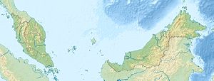
Location map of Malaysia.
Equirectangular projection. Strechted by 100.0%. Geographic limits of the map:
* N: 8.0° N
* S: 0.0° N
* W: 99.0° E
* E: 120.0° E
Made with Natural Earth. Free vector and raster map data @ naturalearthdata.com.
Autor/Urheber: Cccefalon; Pushpin: McSush, Lizenz: CC BY-SA 3.0
Sabah: Scheme of Islands in the Darvel Bay with Pushpin Marker for Pulau Tabawan
Flag of the Malaysian state Sabah. Based on a GIF from a government website, colors from a photo. Drawn by Mysid. The flag was adopted September 16, 1988.
- The mountain on the left is Mount Kinabalu.
Per the Constitution of the State of Sabah:
"The State Flag is in a rectangular shape and is in the proportion of 1:2. The canton which extends at the head half way to the fly and 2/3 at the hoist to the foot is in Icicle Blue (C1T9) as the background to a graphic silhouette of Mount Kinabalu which is in Royal Blue (B10) positioned at ¼ of the height of the canton from end to end. The fly of the flag is divided equally into three bands of colours the foot division of which extends right to the hoist. The top band is in Zircon Blue (C5T5) the second band is in white and the third band is in Chili Red (S6R4)."


