Florida State Road A1A
 | |
|---|---|
| Basisdaten | |
| Gesamtlänge: | 328,92 mi/529,35 km |
| Eröffnung: | 1945 |
| Bundesstaat: | Florida |
| Anfangspunkt: | First Street / Flagler Avenue in Key West |
| Endpunkt: | |
| Countys: | Monroe, Miami-Dade, Broward, Palm Beach, Martin, St. Lucie, Indian River, Brevard, Volusia, Flagler, St. Johns, Duval, Nassau |
Die Florida State Road A1A (kurz FL A1A) ist eine State Route im US-Bundesstaat Florida, die in Süd-Nord-Richtung verläuft. Sie verläuft meist in unmittelbarer Küstennähe entlang der Ostküste des Bundesstaates.
Streckenverlauf
Die State Road beginnt in Key West im Monroe County und führt auf einem kurzen Teilstück des Overseas Highway zusammen mit dem U.S. Highway 1 bis Marathon. Anschließend ist die Streckenführung als A1A bis Miami unterbrochen. Erst der MacArthur Causeway von Miami nach Miami Beach führt wieder diese Bezeichnung. Anschließend führt die Straße bis auf wenige Ausnahmen auf Barriereinseln zwischen dem Atlantic Intracoastal Waterway und dem Atlantischen Ozean an der Küste Floridas entlang. Ausnahmen hiervon sind ein Abschnitt bei Fort Lauderdale, ein weiterer Abschnitt von West Palm Beach nach Riviera Beach, von Jupiter nach Stuart, bei Fort Pierce sowie von Cocoa nach Daytona Beach. In diesen Fällen ist die Streckenführung mit dem U.S. Highway 1 (FL 5) oft identisch. Bei Jacksonville wird der St. Johns River mittels Fährverbindung überquert. Bei Fernandina Beach, kurz vor der Grenze zu Georgia, verlässt die Straße die Küstengegend und biegt nach Westen ab. Sie führt weiter über Yulee, kreuzt die Interstate 95 und endet schließlich in Callahan im Nassau County.
Weblinks
- South East Roads (engl.)

A1A in Boca Raton

A1A in Daytona Beach
A1A in Key West

Halifax Bridge in Port Orange
Auf dieser Seite verwendete Medien

750 mm × 600 mm (30 in × 24 in) U.S. Highway shield, made to the specifications of the 2004 edition of Standard Highway Signs. (Note that there is a missing "J" label on the left side of the diagram.) Uses the Roadgeek 2005 fonts. (United States law does not permit the copyrighting of typeface designs, and the fonts are meant to be copies of a U.S. Government-produced work anyway.)

Vies of Daytona Beach, South on Highway A1A. Photo taken from Ocean Walk Pedestrian Bridge. A1A was the paved portion of the original course for the Daytona Beach Road Course.
30 in by 24 in (750 mm by 600 mm) Florida State Road shield, made to the specifications of the sign detail. Uses the Roadgeek 2005 fonts. (United States law does not permit the copyrighting of typeface designs, and the fonts are meant to be copies of a U.S. Government-produced work anyway.) The outside border has a width of 1 (1/16 in) and a color of black so it shows up; in reality, signs have no outside border. Note that the drawing does not provide the border width or curve radii. (The previous page does but seems very inaccurate.) Thus those measurements are approximated from the drawing. The state outline is extracted from the PDF and cleaned up (to make the inside match the outside).

30 in by 24 in (750 mm by 600 mm) Florida State Road shield, made to the specifications of the sign detail. Uses the Roadgeek 2005 fonts. (United States law does not permit the copyrighting of typeface designs, and the fonts are meant to be copies of a U.S. Government-produced work anyway.) The outside border has a width of 1 (1/16 in) and a color of black so it shows up; in reality, signs have no outside border. Note that the drawing does not provide the border width or curve radii. (The previous page does but seems very inaccurate.) Thus those measurements are approximated from the drawing. The state outline is extracted from the PDF and cleaned up (to make the inside match the outside).

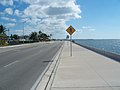
Autor/Urheber: Ebyabe, Lizenz: CC BY-SA 3.0
Key West, Florida: Florida State Road A1A:

600 mm × 600 mm (24 in × 24 in) U.S. Highway shield, made to the specifications of the 2004 edition of Standard Highway Signs. (Note that there is a missing "J" label on the left side of the diagram.) Uses the Roadgeek 2005 fonts. (United States law does not permit the copyrighting of typeface designs, and the fonts are meant to be copies of a U.S. Government-produced work anyway.)

Autor/Urheber: Ebyabe, Lizenz: CC BY 2.5
Dunlawton Avenue/A1A bridge over the Halifax River, in Port Orange, Florida

600 mm × 600 mm (24 in × 24 in) U.S. Highway shield, made to the specifications of the 2004 edition of Standard Highway Signs. (Note that there is a missing "J" label on the left side of the diagram.) Uses the Roadgeek 2005 fonts. (United States law does not permit the copyrighting of typeface designs, and the fonts are meant to be copies of a U.S. Government-produced work anyway.)

Florida State Road A1A in Boca Raton, Florida