Cotton Cay
| Cotton Cay | ||
|---|---|---|
| Satellitenbild von Cotton Cay (Mitte) | ||
| Gewässer | Atlantischer Ozean | |
| Inselgruppe | Turks-Inseln | |
| Geographische Lage | 21° 21′ 47″ N, 71° 9′ 18″ W | |
| Länge | 2,35 km | |
| Breite | 600 m | |
| Fläche | 1,13 km² | |
| Höchste Erhebung | 6 m | |
| Einwohner | unbewohnt | |
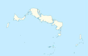
Cotton Cay ist eine kleine Insel in der Gruppe der Turks-Inseln. Sie liegt ca. 2,7 Kilometer nordöstlich von Salt Cay und gehört wie diese zum britischen Überseegebiet der Turks- und Caicosinseln.
Die Insel ist flach, von länglicher Form und etwa 1,13 km² groß. Einige Wege im Südwesten lassen auf einstige Nutzung der heute unbewohnten Insel schließen.
Auf dieser Seite verwendete Medien
Flag of the Turks and Caicos Islands
Satellite Image of Salt Cay (lower left) and neighboring islets. It is the second largest of the Turks Islands.
Autor/Urheber: Carport, Lizenz: CC BY-SA 3.0
Positionskarte der Turks- und Caicosinseln


